I have lately felt a pressing need to understand Singapore’s road map. As in, literally, the map of our roads. Our expressways. I want to know what is where in our country, and I want to know it fairly well. Anybody who knows me personally knows that my understanding of Singaporean topography is horrible. My sense of direction is terrible. It’s not a universal sense, mind you- you can put me anywhere in Vice City (yes, the video game) and ask me to get anywhere else, and I’d know how to. I’m just generally vacant, disinterested and uninvolved in road directions. At least, I have been so far.
Here’s a picture from SingaporeGoDown.com.sg It’s a modern commercial-industrial complex that seems to be trying to be very atas.
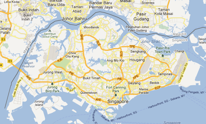
What I’m interested in is the map of the expressways. Have you ever seen anything like that before?
Here is a map of our expressways from an analysis of expressway accidents:
You’ll notice that the KPE is conspicuously absent from the above two diagrams, because they predate it. I showed this picture to a lot of my friends without telling them what it is. Most people couldn’t really figure out what it was.
Here’s a map for a condo site:

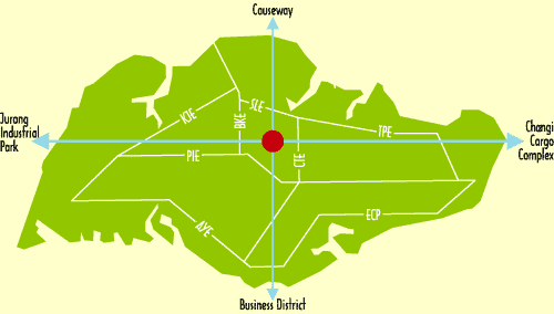
One of the most elegant I’ve seen so far, nice clean lines, and clearly shows how the BKE/PIE split goes. I wonder what the dotted lines are? Oh- they’re the MRTs. Might it be smarter to use the colors of the lines? Red, purple, green, yellow?
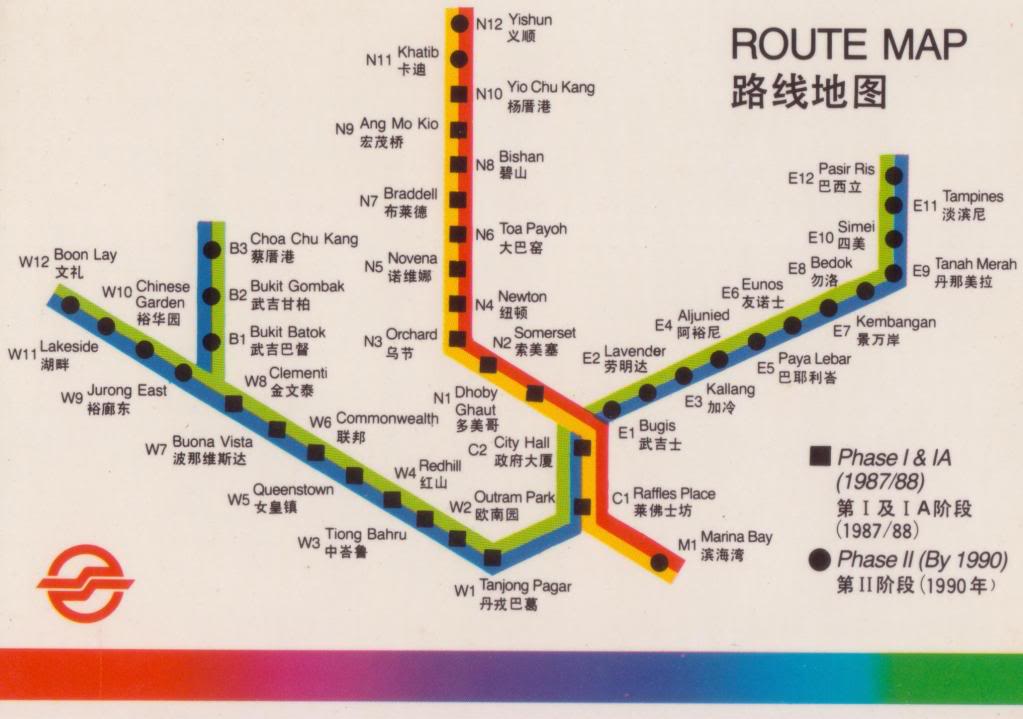
Here’s one with both trains and roads (and NUS, lol)

Nice minimalism, ugly colour scheme. Very dated.
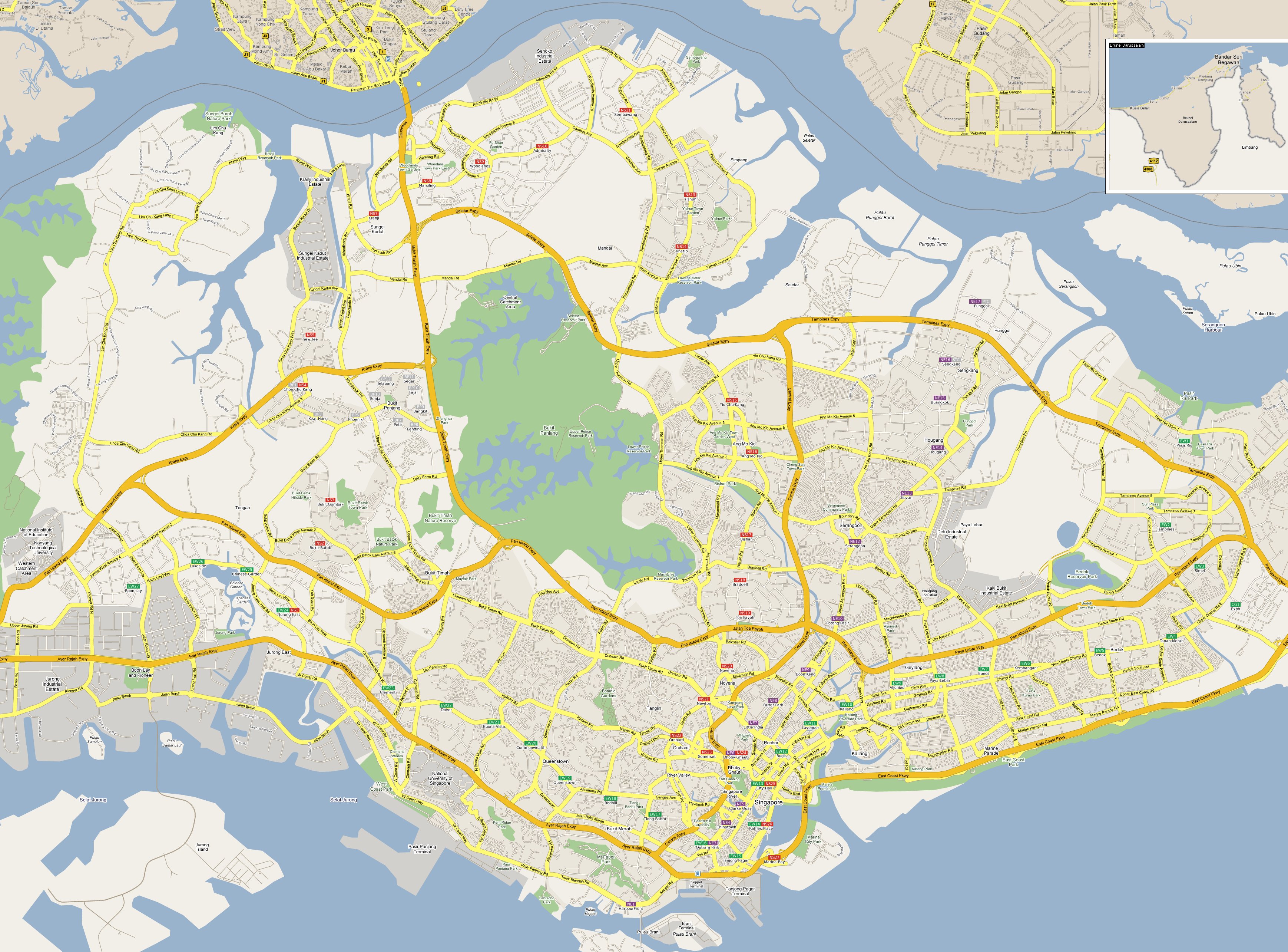
Here’s a pretty nice map from SEAcityMaps.com
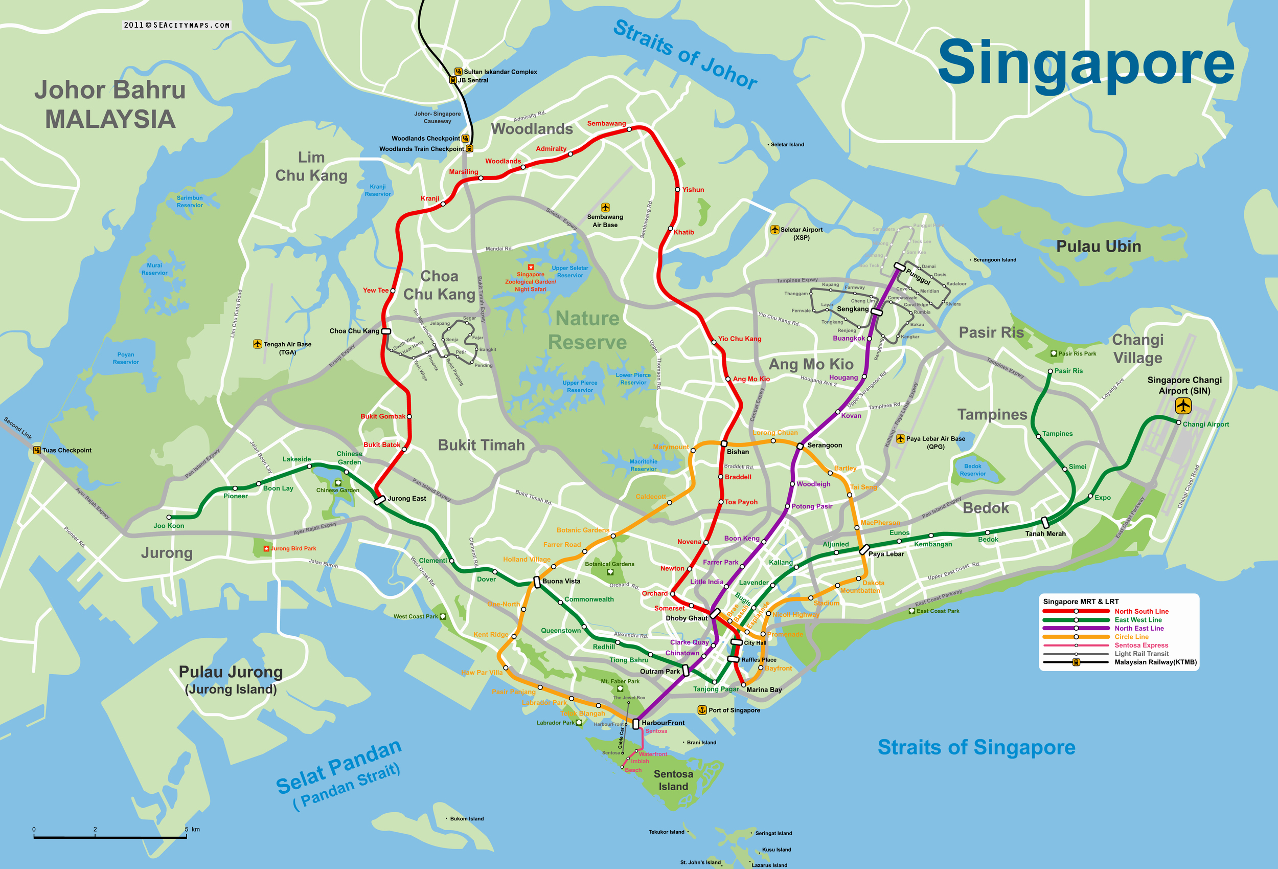
Above is probably my favourite map so far. My slight gripe is-why are the expressways grey and the roads white? I would switch, make the expressways white and the roads grey. Arteries should be more prominent than veins, no? I’d also try to show the population density, which is quite alluded to in the Google map- but there’s no MRT in that one.
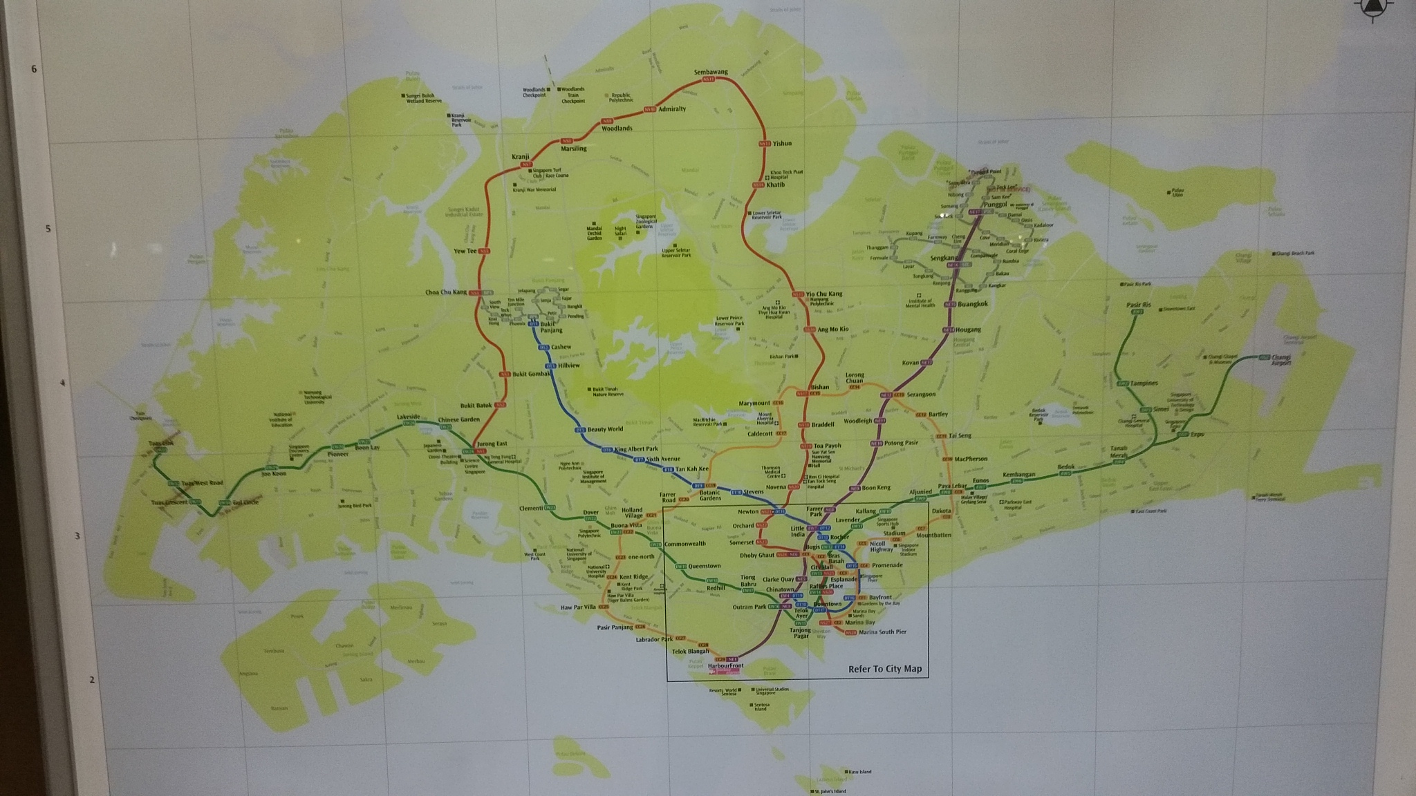
I quite like the detail in this one:
I like how it exposes where the airbases and large army camps are. I suppose some might say that’s a national security issue or something… KPE is missing, though. And the MRT lines. But I think it’s good to just know what the space usage is like. Anyway it’s nearly impossible to hide anything these days…
This entire blogpost is my long-winded, convoluted way of saying- I think that we ought to have an awesome map (or several maps) that beautifully express our expressways (heh), MRT maps, etc- it’ll be a beautiful thing to have, and it doesn’t exist. Opportunity for artists to be known/heard! You heard it here. 😀
Looking for fun, Singapore-themed t-shirts? They make great gifts. Check out Statement.sg!
The last picture reminds me of metro train map!
Happened to drop by your informative blog about expressways. I too am a noob. Thanks for the post!